
Yellow River
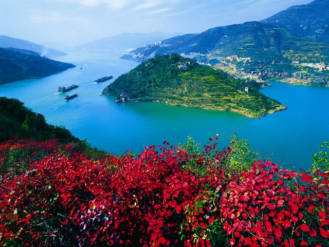
Yangtze River
|
Rivers
Perhaps the two most important geographical features of Ancient China were the two major rivers that flowed through central China: the Yellow River to the north and the Yangtze River to the south. These major rivers were a great source of fresh water, food, fertile soil, and transportation. They also were the subjects of Chinese poetry, art, literature, and folklore. Yellow River The Yellow River is often called the "cradle of Chinese civilization". It was along the banks of the Yellow river where the Chinese civilization first formed. The Yellow River is 3,395 miles long making it the sixth longest river in the world. It is also called the Huang He River. Early Chinese farmers built small villages along the Yellow River. The rich yellow colored soil was good for growing a grain called millet. The farmers of this area also raised sheep and cattle. Yangtze River The Yangtze River is south of the Yellow River and flows in the same direction (west to east). It is 3,988 miles long and is the third longest river in the world. Just like the Yellow River, the Yangtze played an important role in the development of the culture and civilization of Ancient China. Farmers that lived along the Yangtze River took advantage of the warm climate and rainy weather to grow rice. Eventually the land along the Yangtze became some of the most important and wealthy land in all of Ancient China. The Yangtze also served as a boundary between northern and southern China. It is very wide and difficult to cross. The famous Battle of Red Cliffs took place along the river. |
Mountains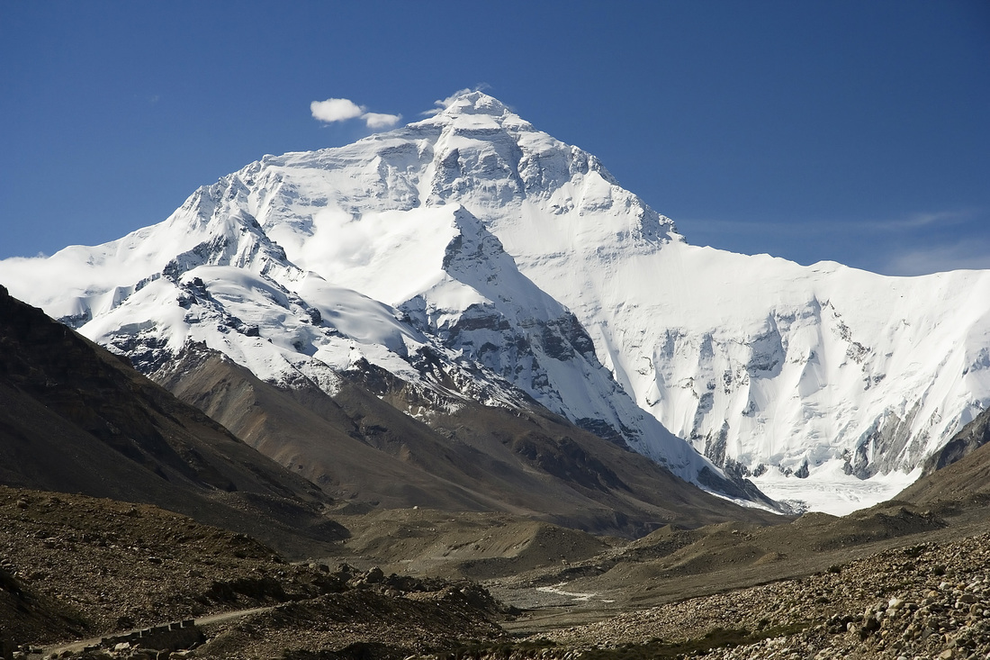
Himalaya Mountains
To the south and southeast of China are the Himalaya Mountains. These are the highest mountains in the world. They provided a nearly impassable border for Ancient China, keeping the area isolated from many other civilizations. They were also important to Chinese religion and were considered sacred.
|
Deserts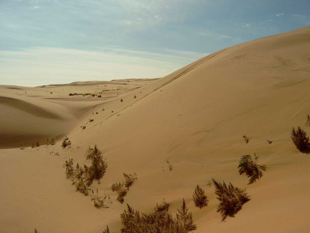
Gobi Desert
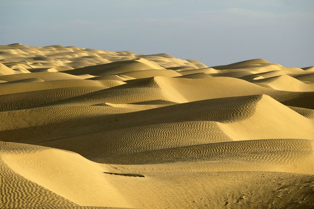
Taklamakan Desert
To the north and west of Ancient China were two of the world's largest deserts: the Gobi Desert and the Taklamakan Desert. These deserts also provided borders that kept the Chinese isolated from the rest of the world. The Mongols, however, lived in the Gobi Desert and were constantly raiding cities of northern China. This is why the Great Wall of China was built to protect the Chinese from these northern invaders.
|
Interesting Facts
- Today the Three Gorges Dam on the Yangtze River serves as the world's largest hydro-electric power source.
- The Yellow River also has the name "China's Sorrow" because of the terrible floods that have occurred throughout history when its banks overflowed.
- The Taklamakan Desert has the nickname of the "Sea of Death" because of its temperature extremes and poisonous snakes.
- Much of the Silk Road traveled along the deserts to the north and west of China.
- The religion of Buddhism is closely associated with the Himalaya Mountains.
How did geography affect life in Ancient China:
Rivers
Rivers
- For thousands of years, the river has been known as the mother river of the Chinese nation, both in the writings of the poets and scribes, and in the hearts of the Chinese people. Almost all the Chinese see themselves as the children of Yellow River. The Yellow River has the same relationship with China. If China had no Yellow River, the Chinese wouldn't have a place to focus their spiritual energies on.
- Yellow River drainage basin is the birthplace of Chinese nation and meanwhile it is the cradle of Chinese civilization. In this vast cradle, Yellow River civilization, which is the principal part of the whole Chinese civilization and plays a crucial role in the history of civilization development, grew with vitality. It had stood the test of almost all kinds of upheavals and difficulties, and finally created the continuous Chinese civilization.
- From the Xia (21st-16th century BC) and Shang (16th-11th century BC) Dynasties to the Tang Dynasty (618-907), the Yellow River area was always the center of politics, economy and culture.
- There are many ingredients of Yellow River civilization, such as potteries, silks, bronze, characters, and so on. Commonly, it came into being between the year 4,000 BC and 2,000 BC, which covered over 2,000 years long. During this period of time, a group of regional civilizations were booming but unfortunately in later time, some of them intermitted; some went to the low tide.
- Only Yellow River civilization assimilated the essences of other regional civilization and developed itself into a higher level. The phase of the development of Yellow River civilization was also a period for its sublimation. And the epoch of the prosperity of this civilization was the historical moment when China stepped into the feudal empire civilization.
Mountains
- In ancient times, China's geography included natural barriers of fierce deserts and the Himalaya Mountains.
- The Himalayas are not located in modern day China. China's borders have changed over the years. They run along near the border of southern China. The Himalayas are very high mountains. Ten of the highest mountain peaks in the world are found in the Himalayas, one of which is Mount Everest, the very highest peak in the world.
- In ancient times, as it is today, it is very difficult to climb over the Himalaya Mountains. These mountains helped to protect the early people who settled in the interior of China, along the banks of China's two major river systems, from invasion. For many year, China was isolated from the rest of world, in great part due to her natural barriers.
- Sometimes people describe China's landscape as being like a staircase with three steps. The top step of this staircase is in the west, where the Himalaya mountains are (India is on the other side of these mountains)
Desert
- The Gobi Desert is dangerous and dry. There is a little water, but is rare, and an oasis is very rare.
- The Taklamakan Desert China's other desert, is the second largest desert in the world. It's nickname is the Sea of Death. Sand storms whip up frequency, and without warning. The days are boiling hot. The nights are freezing cold. The snake are poisonous. There is little hope of water. Crossing the Taklamakan is dangerous and can be deadly. It is one of China natural barriers.
- Ancient China Geography
-Copyright 2016, All Rights Reserve
-ducksters.com
